
A severe thunderstorm watch is in effect until 10 p.m. Forecasters at the National Weather Service say damaging wind gusts and large hail are the primary threats. An isolated tornado is also possible.
A Flood Watch for potential flash flooding is in effect from 4 p.m. through this evening for the Washington, D.C., and Baltimore metro areas, southern Maryland, and eastern Virginia. Elsewhere, an isolated instance of flooding is possible as well.
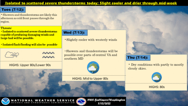
This Afternoon
A chance of showers and thunderstorms. Some storms could be severe, with large hail, damaging winds, and heavy rain. Sunny, with a high near 93. Southwest wind around 10 mph. The chance of precipitation is 50%.
Tonight
Showers and thunderstorms, mainly before 10 pm. Some storms could be severe, with large hail, damaging winds, and heavy rain. Low around 71. Northwest wind around 6 mph becoming calm in the evening. The chance of precipitation is 80%. New precipitation amounts between 1 and 2 inches are possible.
Wednesday
Mostly sunny, with a high near 89. Calm wind becoming west around 6 mph in the morning.
Wednesday Night
Mostly cloudy, with a low around 70. Light and variable wind.
Thursday
Mostly sunny, with a high near 88. Northwest wind 3 to 7 mph.