
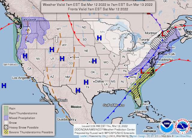
Rain will begin falling across the region on Friday night will intensify during the overnight hours into Saturday morning.
Strong winds coming with the rain will also cause temperatures to fall rapidly. On Saturday morning, the temperatures will be in the 40s and 50s. According to the National Weather Service, as a cold front moves through, the mercury will drop into the 20s and 30s by afternoon.
The sudden temperature drop could mean the snow for some around the Washington, D.C. area.
“There is still some uncertainty as to how much precipitation will be left by the time the cold air arrives, but it does appear increasingly likely that there will be accumulating snow in the farther northern and western suburbs of Washington/Baltimore toward the Allegheny Highlands,” according to the National Weather Service.
The sooner the cold air arrives, the more likely there will be accumulating snow, it adds.
Strong winds are expected behind the cold front, at least Saturday evening. Gusts from 50 to 55 mph are likely across much of the area. Some higher gusts around 60 mph cannot be ruled out, especially in the weather service states’ ridges.
Winds may gradually diminish later Saturday night while dry and icy conditions persist.
High pressure will build into the region Sunday through Tuesday. Sunday will be chilly, despite plenty of sunshine, with temperatures 5 to 10 degrees below average.
Temperatures on Monday will be milder, nearly 10 degrees above average, with some increasing clouds. Tuesday will also be mild, and so will Wednesday, with temperatures 10 to 15 degrees above average.
Expect rain on Wednesday.