
Good morning. If you’re asking yourself today if shorts are part of the “business casual” look, we say yes.
A mass of hot air moves into our region today, and it’s going to be a scorcher with temperatures approaching 100 degrees.
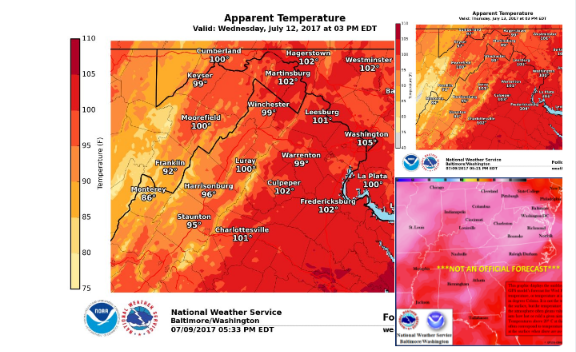
From the National Weather Service:
A hot & humid airmass will move in this week, peaking Wed/Thu. Here’s a look at how hot it may feel! #heat #DCwx #MDwx #VAwx #WVwx pic.twitter.com/syFpzomEVF
— NWS DC/Baltimore (@NWS_BaltWash) July 9, 2017
The heat could be record setting, forecasters warn:
Heat and humidity return this week. Here is a look at temp records for DCA, IAD and BWI. Prepare for heat indices near 100 deg Wed – Thu. pic.twitter.com/AGbdtBlBx6
— NWS DC/Baltimore (@NWS_BaltWash) July 10, 2017
A true summer pattern has set up over the region with a chance of thunderstorms in the forecast every day through Sunday. High temperatures will hover near the century mark through Thursday and then fall into the high 80s and low 90s on Friday through the weekend.