
More snow, you ask?
This next winter storm that’s expected to impact our area Monday night into Tuesday won’t be anywhere near as big as the January blizzard that dumped more than two feet of snow on our area.
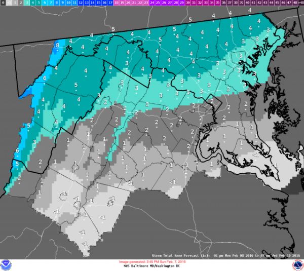
This time, forecasters at the National Weather Service said we’re looking at the potential of only two inches at most from this storm.
Rain on Monday will turn to snow after the sun sets, according to the weather service. Most of the snow should fall overnight, and warmer temperatures on Tuesday will limit higher amounts of snow we could see with this storm.
Low temperatures on Monday night should dip reach the freezing mark. Expect high temperatures on Tuesday in the upper 30s.
Higher snow accumulations are expected further north and west of Washington, D.C. Expect one to three inches of snow possible for our immediate area, according to the weather service.
On Wednesday, a chance of snow showers remains with high temperatures in the high 30s. Wednesday night will be mostly cloudy and cold with low temperatures in the low 20s.
Thursday will be mostly sunny and cold with high temperatures in the low 30s.