
Flooding, high winds possible
Possible flooding is in the forecast for our area Wednesday as a large cold front is expected to march across our region tonight into tomorrow.
Damaging winds could also accompany the cold front, coupling with heavy rains to make Wednesday a complete wash out.
The rain should arrive during the overnight hours, and then we could see a thunderstorm after 5 a.m., according to the National Weather Service. During the day, Wednesday, the wind picks up with gusts up to 23 mph, and rainfall totals of a half to three-quarters of an inch are possible during the day.
Showers and thunderstorms will continue into the evening, until about 10 p.m., when we could see another half inch of rain. While it’s likely we won’t see severe thunderstorms from this weather system, the rain is expected to be heavy at times.
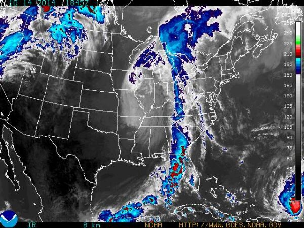
The storm bringing all this rain to our region is a low pressure system from the Great Plains region of the U.S. The cold front associated with the weather system is vast, stretching from the southern U.S. to southern New England.